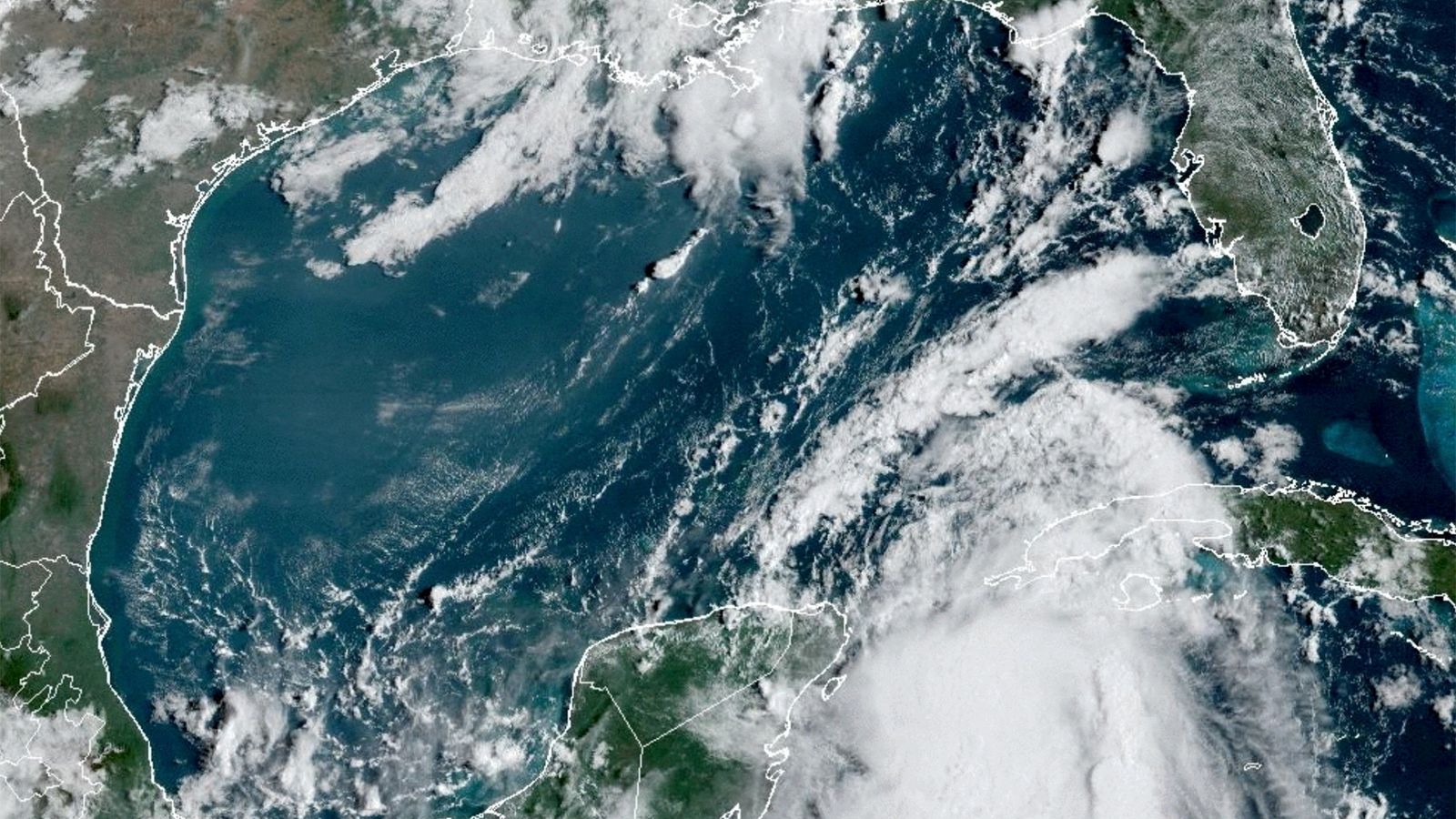
Idalia was upgraded from a tropical storm to a hurricane early on Tuesday after causing major flooding and landslides in Cuba.
It’s due to hit Florida in the early hours of Wednesday, putting 14 million people there at risk.
Although not unusual during hurricane season, which runs from 1 June to 30 November, Idalia is intensifying faster due to high sea temperatures – making it harder to prepare for and more deadly as a result.
Here, Sky News tells you all you need to know.
Where in the US will it hit?
Idalia is expected to make landfall as a Category 3 hurricane on Florida’s northwestern coast at around 6am (local time) on Wednesday – bringing 10 to 20cm (3 to 8in) of rain and winds of more than 110mph (177kmph).
From there it will move eastwards across the north of the state, just north of Jacksonville, before it reaches the border with Georgia at around 6pm.
Two killed after helicopter crashes into apartment building in Florida
Ryan Palmeter: Gunman who killed three in Florida shooting is named – as police say he ‘hated black people’
Erik Compton: Heart transplant golfer charged after ‘pushing wife against wall’, Miami police say
Beyond Florida it will move along the Gulf of Mexico coastline to Georgia, South and then North Carolina on Wednesday and Thursday.
Storm surge warnings are in place across Tampa Bay and the ‘Big Bend’ part of Florida, with 8ft (2.4m) to 12ft (3.7m) of floodwater expected between the Chassahowitzka and Aucilla rivers, according to the National Hurricane Center.
A separate hurricane warning applies to Florida’s Gulf Coast on Wednesday and Thursday, bringing with it the risk of heavy rainfall and urban flash flooding.
Walls of surging seawater being pushed inland to coastal areas by high winds are among the biggest dangers, authorities have said.
What damage has it done in Cuba?
Idalia hit the northern tip of Cuba with heavy rain and wind over the weekend. Up to 10cm (4in) fell on Sunday alone, according to local meteorological stations.
Thousands along the west coast were evacuated from their homes as they filled up with floodwater.
Pinar del Rio, known for its tobacco production, was one of the provinces battling the effects of Idalia – while still recovering from the devastation of Hurricane Ian a year ago.
The Category 5 hurricane killed 150 people and damaged tens of thousands of homes and businesses.
What measures are being taken?
Governor Ron DeSantis has declared a state of emergency in 46 of Florida’s 67 counties from the Gulf to the Atlantic Coast.
There are evacuation notices in 21 counties, including eight mandatory orders – mainly across low-lying, coastal areas and where mobile homes are more common.
Tampa International and St Pete-Clearwater International airports are closed on Tuesday and Orlando’s Sunrail train service is suspended.
Highway tolls are being waived allowing people to evacuate more easily, Mr DeSantis said.
Read more from Sky News:
Storm Hilary leaves one dead in Mexico
Devastating impact of Hawaii wildfires
Tropical rainforest leaves so hot they can’t photosynthesise
Schools along the Gulf Coast are mostly closed on Tuesday and Wednesday, along the University of Florida in Gainesville.
While Walt Disney World, Universal Orlando and Legoland Florida remain open, Busch Gardens Tampa Bay will be closed due to Idalia from 3pm on Tuesday to opening on Thursday.
Some 1,1000 members of the National Guard are on standby equipped with 2,400 high-water vehicles and 12 aircraft to help with rescue efforts.
Why could it prove more dangerous than usual?
Idalia risks a phenomenon called ‘rapid intensification’.
As the name suggests, it’s when a storm increases in strength faster than normal. Scientists declare it when wind speeds pick up by at least 35mph in 24 hours or less.
Historically tropical storms took several days to turn into hurricanes. But climate change and increasing temperatures – particularly sea temperatures – have made quicker surges more and more common.
More than 90% of global warming has happened in the ocean, according to the National Oceanic Atmospheric Administration.
Please use Chrome browser for a more accessible video player
The Gulf of Mexico has some of the warmest seawater on the planet at this time of year. Sea surface temperatures there have been 31C (88F) so far this week – 1.4C (2.6F) above average.
This heat gives storms like Idalia the energy they need to strengthen.
Although they’re unlikely to meet – Hurricane Franklin is also heading across the Atlantic to Bermuda at the same time as Idalia works its way through the Gulf.
If their paths were to cross they would likely absorb one another in a phenomenon known as the Fujiwhara effect.
A recent example is when Storm Hilary and Irwin collided off the coast of Mexico in 2017.


