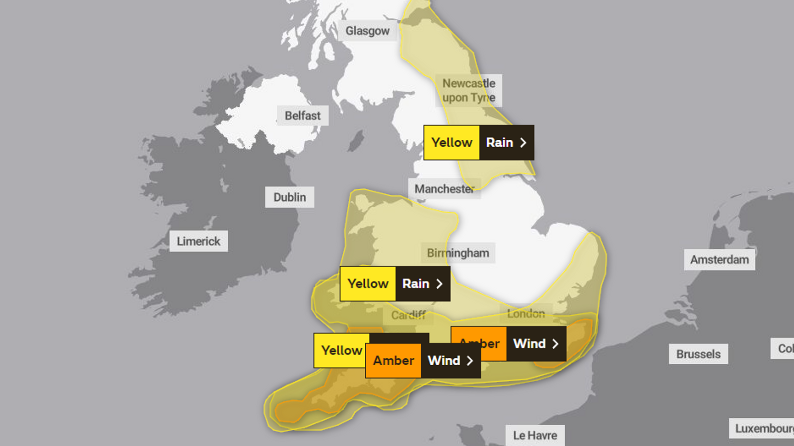
Storm Ciaran has made landfall in the UK and with it strong winds and heavy rain could last for three days – prompting school closures and major travel disruption.
While the worst of the weather has so far been concentrated in the south, heavy rain and powerful winds are expected to affect much of the UK.
Here is a list of warnings, where the bad weather is expected to hit and when.
Check your local forecast by putting your area in here
Amber wind warning – 6am to midday on Thursday
This covers the following areas:
East Sussex
Kent
On Thursday morning, very strong west to southwesterly winds are likely to develop across parts of East Sussex and Kent, the Met Office said.
Gusts of 70-80mph are possible and could get over 85mph in a few of the most exposed coastal spots.
Follow latest: Storm Ciaran brings wind speeds of up to 104mph
Yellow rain warning – 6pm on Wednesday to midnight on Thursday
This covers the following areas:
East of England
London and South East England
North West England
South West England
Wales
West Midlands
Heavy rain is expected throughout Thursday as Storm Ciaran sweeps the country. 20-30mm is likely quite widely, but a number of places may see 40-60mm.
Upland areas of southwest England and Wales may see 80mm of rain, while a few places in northern Wales could get more than 100mm, the Met Office said.
“Given this amount of rainfall, the current saturated conditions, and the potential for fallen leaves to block drains etc, further impacts are likely,” the Met Office warned.
Yellow wind warning – 9pm on Wednesday to midnight on Thursday
This covers the following areas:
East of England
London and South East England
South West England
Wales
Winds are likely to frequently gust 50-60mph inland, and could reach 70mph in a few exposed locations, mainly coasts and hills.
Some damage to buildings, such as tiles blown off roofs, is possible and flying debris could cause injuries and danger to life. Some travel disruption is expected and there could be power cuts.
Yellow rain warning – 6am on Thursday to 6am on Friday
This covers the following areas:
Central, Tayside and Fife
Grampian
Highlands and Eilean Siar
North East England
Southwest Scotland, Lothian Borders
Yorkshire and Humber
The yellow warning for rain associated with Storm Ciaran extends as far north as Aberdeen, with people in parts of northeast England and eastern Scotland told to expect periods of heavy rain.
Strong easterly winds, becoming northerly by Friday morning, will accompany the rainfall, and could exacerbate its impacts, the Met Office warned.
Yellow rain warning – 3pm on Saturday to midnight on Saturday
This covers the following areas:
East Sussex
Hampshire and Isle of Wight
Kent
West Sussex
Frequent heavy showers, along with gusty winds, are likely to cause travel disruption and flooding of a few places, the Met Office said.
There could be dangerous conditions at the coast and buses and trains are likely to be affected.


