A tropical cyclone has hit the western coast of Australia with winds of more than 100mph (170km) and much of the area put on “red alert”.
A spokesman for the Bureau of Meteorology, Todd Smith, said cyclone Seroja was now at category two but had reached “category three cyclone intensity” with damaging winds which would continue into the night.
Emergency services opened shelters in preparation for the high winds and coastal flooding.
Category 2 #TCSeroja rapidly moving southeast. Impacts to the west coast of WA begin this afternoon and inland parts this evening and overnight. Dangerous conditions including destructive wind gusts, intense rainfall and a dangerous storm tide. Latest info https://t.co/bku7VbhoZa pic.twitter.com/UD1DrGfve9
The Department of Fire and Emergency Services (DFES) said in a bulletin: “There is a possible threat to lives and homes.
“You need to take action and get ready to shelter.”
The DFES has so far put five coastal towns on “red alert”.
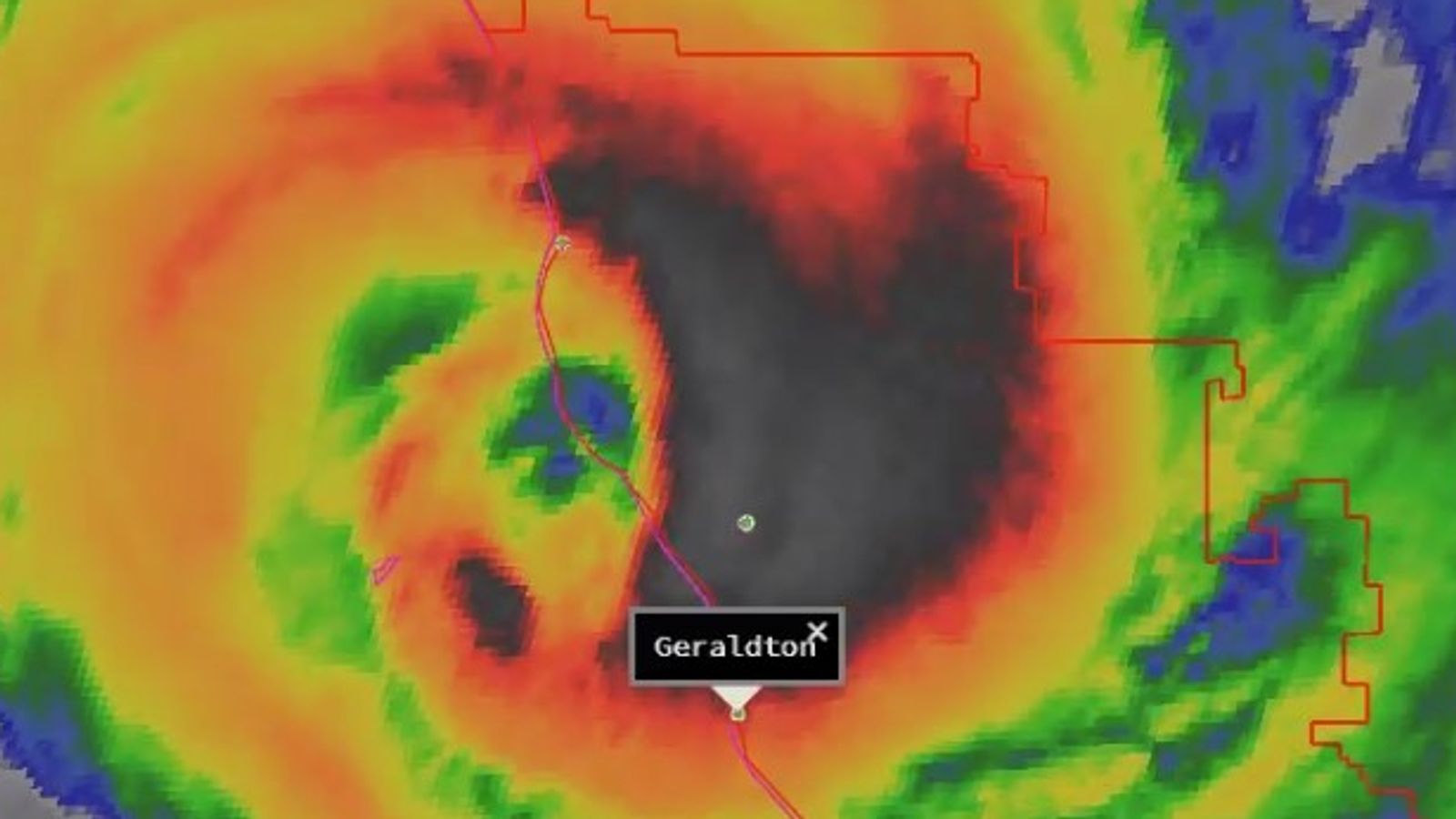
The very destructive core of Category 3 Severe Tropical #CycloneSeroja is crossing the coast now between Kalbarri and Gregory. Kalbarri recorded a 170 km/h wind gust at 7:03pm WST and has seen 111 mm of rain since 9am. Live radar: https://t.co/C9i0l7u9yA pic.twitter.com/laeqtMXxKw
Some towns north of Perth were evacuated while sandbags were being made available to residents further down the coast.
A category three classification can see wind speeds of up to 170mph (224km).
After touching down on the north western town of Geraldton (124 miles/200km north of Perth) and dumping more than 10cm of rain in just two hours, tropical cyclone Seroja headed inland, lessening slightly in intensity.
However, officials were still braced for a “high degree of damage” to buildings in the area.
A spokesman for the Western Australia emergency services department explained that buildings were not constructed to withstand such strong winds in a region as it typically too far south to fall into the path of cyclones.
