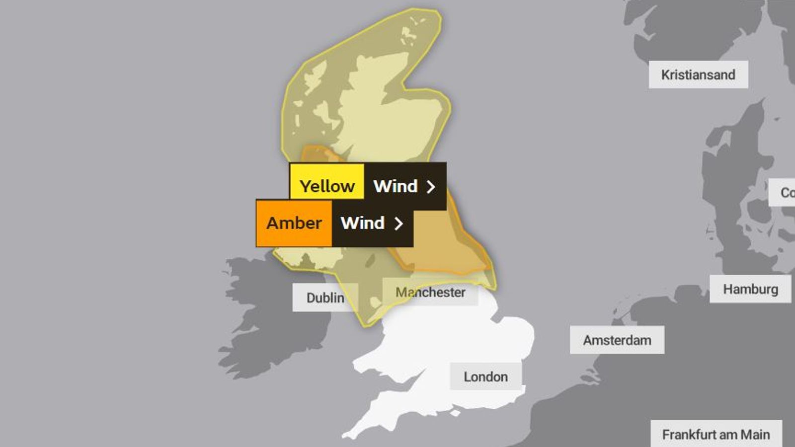
The UK is expected to be hit by two storms in the space of three days this week with forecasters warning of 90mph winds across the north of England and Scotland, while some regions could face “blizzard conditions”.
Storm Dudley will cross the northern half of the UK from Wednesday night into Thursday morning, while Storm Eunice will bring strong winds and potentially some snow for parts of the country on Friday.
The Met Office added an amber warning to a yellow alert already in place, when naming the first of the two storms expected to cause disruption.
“Storm Dudley is expected to affect the UK on Wednesday night and Thursday, bringing a period of very strong and disruptive winds,” the Met Office said.
The amber alert warns of gusts of 70-90mph from 6pm on Wednesday to 9am on Thursday for southern Scotland, north England and the north of Northern Ireland.
The yellow wind warning is in place for the north of the UK from 3pm on Wednesday to 6pm on Thursday with estimates of winds of 60-70mph.
A Met Office spokesman said: “With regard to Storm Dudley, snow will mostly be on high ground, with the highest accumulations in the Grampians.
UK weather: Sleet and snow flurries forecast and ice warning issued as temperatures set to plummet
‘Bomb cyclone’ batters US East Coast with Nor’easter bringing mounds of snow and ‘life-threatening’ weather conditions
UK weather: Storm Malik forecast to deal ‘glancing blow’ this weekend as Met Office issues yellow warnings
“Lower down, any snow is likely to be short-lived but when it is coming down it is likely to be blizzard conditions.”
Please use Chrome browser for a more accessible video player
The warnings mean there is a chance of injury and danger to life from large waves and debris thrown onto coastal roads, sea fronts and properties.
There is also a risk of falling trees, damage to buildings and power cuts.
“It’s not just going to be strong winds this week,” Met Office meteorologist Tom Morgan said, who warned there could be snow in Scotland, Northern Ireland and northern England, adding snow and ice warnings would likely be issued over the next few days.
And, according to the forecaster, the bad weather will not just be confined to northern parts of the UK.
“The southern parts of England and Wales will see their turn. It looks very, very windy in the south at this stage for Friday,” he said.
“There could be some quite widespread travel disruption in parts of the UK through this week.”
Meanwhile, the Met Office also named Storm Eunice, with the system potentially bringing heavy rain and snow to some parts.
“This system is also expected to bring some heavy rain and there is a potential for some significant snowfall over hills in the Midlands and further north,” the Met Office said.
Expected to track across central areas of the UK on Friday, the storm could spark gusts up to 60-70mph.
The Met Office has a yellow wind warning in place for the storm from the early hours of Friday morning until 9pm for all areas apart from central and northern Scotland.
The Met Office said there is a possibility of this escalating to amber.
Mr Morgan said: “All parts of the UK will see some very strong winds at times.
“It’s Scotland and the North’s turn on Wednesday and into Thursday, and then it’s probably going to be the southern parts of England and Wales that will see the very strongest winds on Friday.”


