Satellites as small as a shoebox are giving the public eyes and ears on a conflict zone as never before, Sky News has been told.
The military has had access to crisp battlefield images for many years, but great strides in technology have made it possible for private companies to launch their own satellites that give an independent view of troop movements and bomb damage.
Sky News has been inside the dust-free “clean room” of Spire, which builds nano-satellites on a Glasgow business park. It already has around 120 satellites in orbit, measuring just 10cm x 10cm x 30cm.
They can listen in to signals from ships and aircraft, tracking their location as well as details of their origin, destination, and purpose.
They saw the Russian navy switch off their tracking beacons just before the invasion, and grain exports from Ukrainian ports dwindle as the government secured the food supply.
Joel Spark, Spire’s co-founder, said that until recently, satellites were as big as a bus and could only image small areas at a time.
“By shrinking the satellites down and miniaturising the technology, so they are more capable, you can deploy them more cost effectively and deploy many more of them,” he said.
“These small satellites are giving 24/7 coverage in areas where it was previously not possible.”
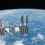
Taking a satellite up to the International Space Station, where many are deployed from, costs £15,000 for every kilogram.
“Every gram counts. It makes a massive difference to the cost,” said Mr Spark.
Key developments:
• Ukraine says nearly 9,000 Russian soldiers have been killed – as first major city ‘falls’ to invaders
• One million people have now fled Ukraine
• Putin wants all of Ukraine and ‘worse is to come’, warns Macron
• Five children among those detained in Moscow
• Oligarchs have megayachts seized by France and Germany
High resolution pictures of the conflict have come from US companies such as Maxar Technologies and Planet Labs.
Their orbiting cameras are slightly larger – roughly the size of a slim dishwasher – and can “see” objects as small as 30cms across.
Maxar takes pictures of 680,000 square kilometres of the planet every day.
Its images of Ukraine are now being used by the military, humanitarian organisations and the media. It took the pictures of the armoured convoy heading for Kyiv.
Planet also releases images almost in real-time – even capturing a missile being launched, with its plume clearly visible against the snow-white landscape.
Professor David Stupples, an expert in space-based reconnaissance at City University, said it’s the first time such clear images of a conflict have been in the public domain.
“These images would have been in the past closely guarded because of the amount of intelligence that’s in them,” he said. “So the Russians, I would have thought, would be upset that the whole of their campaign is now being viewed by the public in very close to real time.”
Even the ageing Sentinel-1 satellite, owned by the European Space Agency, has been used for open source intelligence.
The satellite bounces radar off the Earth’s surface, using the echo to build an image, similarly to a bat.
But scientists discovered that in parts of the world the image was distorted – and realised the interference was caused by powerful ground-based military radar.
Ollie Ballinger, a remote imaging specialist at University College London, has written an open source tool called the Radar Interference Tracker that allows the public to search Sentinel-1 images for tell-tale signs of missile defence systems.
He used it to detect a Russian training exercise in Belarus shortly before the invasion, and said the public no longer has to rely on official sources for information.
He told Sky News: “In the conflicts I have lived through – the invasion of Iraq, for example – the only images were released by the US Department of Defence. You just had to take their word for it.
“Now anyone with an internet connection can check for themselves. It’s democratisation of knowledge – and that’s a good thing.”
But Professor Stupples said images can still fit a narrative that suits the authorities.
“NATO certainly has benefited or is benefiting from some of these public images being made available, mainly from a propaganda perspective, because most of the military satellites would be monitoring this very closely anyway,” he said.
“NATO could use this and turn around and say this is what the Russians are doing, specifically to prove that they are not telling the truth about this conflict.”


